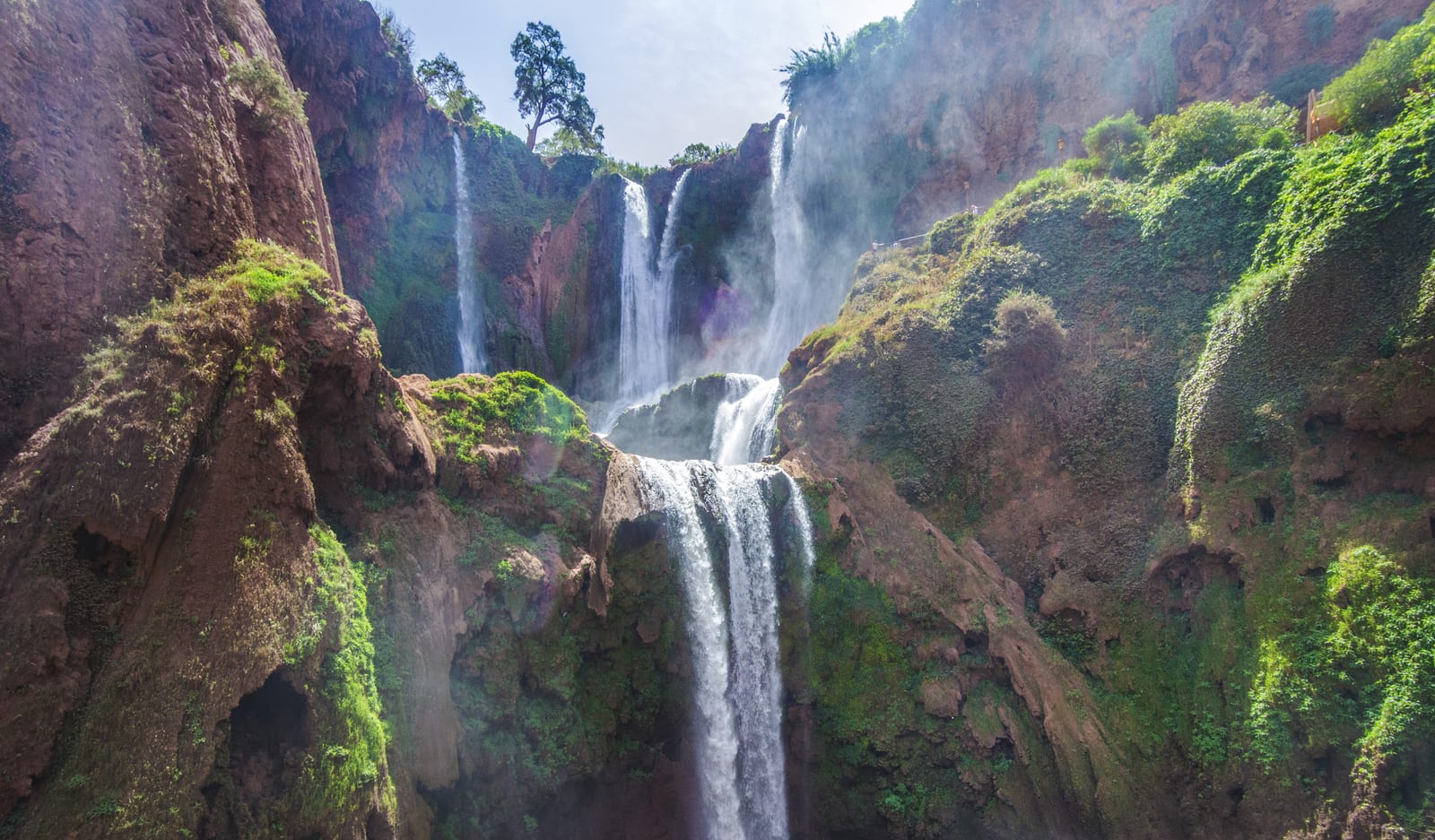
Ouzoud Falls is a natural destination in Azilal province, Morocco. The province lists it at Ouzoud, Aït Taguella, between the High and Middle Atlas. Its published map point identifies the site, not a confirmed entrance or an accessible route.
ONMT: about 100 m⭐ 4.6/5 · 20,340Access: confirm locally
Google Maps snapshot manually checked 29 October 2026; not automatically updated. This guide does not collect these reviews. Rights remain with the original reviewers and Google Maps.
Ouzoud Falls is a natural destination in Azilal province, Morocco. The province lists it at Ouzoud, Aït Taguella, between the High and Middle Atlas. Its published map point identifies the site, not a confirmed entrance or an accessible route.
Ouzoud Waterfalls ← Ouzoud ← Azilal ← Morocco
📍
Arrival and entrance
Ask where legal parking and drop-off are available on your visit date, how charges are calculated and where you will meet your driver again. A map marker is not an entrance or parking-space guarantee.
ℹ️
Access: confirm locally
Google Maps showed “free” and “24 hours” in the 29 October 2026 listing snapshot. No current authority timetable or uniform admission tariff was verified. These labels do not establish safe night access, free parking, a free boat ride or unrestricted entry to every path.
Water & oasis
Red rock, olive trees and white water
Choose a permitted viewpoint after checking the current route and return climb. Ask specifically about steps, gradients, surfaces, barriers, seating and boarding assistance where relevant. This guide has not audited an accessible route and does not guarantee a complete descent for every visitor.
Getting around
Location and access to Ouzoud in Ouzoud
Driver or private trip
From Marrakech, confirm your exact pickup, destination, total price, waiting time and return arrangement before booking a driver or excursion. A quoted journey time can change with roads and traffic; leave adequate daylight for the visit.
Group excursion
For a group trip, ask what the price includes: transport, guiding, meals, parking, optional activities and return pickup. Confirm the provider and cancellation terms directly; this guide does not sell or endorse an excursion.
Public transport
For public transport or a shared taxi, confirm the actual connection, final stop, last return and the final approach before departure. Do not assume a frequent direct service or a vehicle waiting at the waterfall.
Ask where legal parking and drop-off are available on your visit date, how charges are calculated and where you will meet your driver again. A map marker is not an entrance or parking-space guarantee.
Plan with current information
Choose a permitted viewpoint after checking the current route and return climb. Ask specifically about steps, gradients, surfaces, barriers, seating and boarding assistance where relevant. This guide has not audited an accessible route and does not guarantee a complete descent for every visitor.
At the table
Local food after the walk
Menu and total
Ask for a current menu and the total price before ordering; check whether drinks, service or a view-side table cost extra. This guide has not verified specific businesses or today’s menu.
Dietary needs
For allergies or dietary requirements, speak directly with the seller about ingredients and preparation. Bring the drinking water and supplies your group needs rather than relying on a stall being open.
Optional services
Before paying for a guide or boat, agree the route, duration, included services, equipment and cancellation terms. No current operator or activity tariff has been verified here.
Near the falls
Sights and places around Ouzoud
The national tourism office presents Ouzoud within the Azilal nature region and also mentions Imi N’Ifri near Demnate and Bin El Ouidane. They are separate destinations with their own access and transport; this is not a promise of a short or easy combined loop.
Azilal / أزيلال
The national tourism office presents Ouzoud within the Azilal nature region and also mentions Imi N’Ifri near Demnate and Bin El Ouidane. They are separate destinations with their own access and transport; this is not a promise of a short or easy combined loop.
Reviews
What visitors say about Ouzoud Waterfalls?
4.6
★★★★★
Based on 20,340 reviews
Google Maps snapshot manually checked 29 October 2026; not automatically updated. This guide does not collect these reviews. Rights remain with the original reviewers and Google Maps.
Model near Ouzoud, not a waterfall weather station or an access/safety clearance.
Requesting a fresh forecast…
A regional forecast does not measure river force or the full upstream catchment and cannot confirm an activity or safe access. Refreshes every15minutes while active; failed requests clear the numbers.
The Moroccan National Tourist Office’s nature page describes a waterfall of about 100 metres; older official brochures use about 110 metres. These are attributed descriptions, not a new measurement. The province’s 1,060 metres refers to site elevation, not waterfall height.
The provincial page explains the destination’s landscape and regional tourism role. Those background sources do not report the current river flow, path condition, boat operation or a safe swimming area. Historical photographs likewise do not establish today’s conditions.
When to visit
Plan with current information
Regional model forecast, not a measurement at the waterfall or a statement that paths are open. Fresh data only; no old build-time snapshot or climate average is substituted.
Choose a date
1
Before choosing a date, compare a recent regional forecast with official warnings and local access information. No fixed month guarantees ideal water flow, clear skies or safe paths.
After rain
2
After rain, ask about local closures and route conditions before descending. Do not infer that a forecast for the village describes the whole upstream catchment or river response.
Clothing and pace
3
For a warmer forecast, plan shade, water and a pace suited to your group. For a cooler forecast, bring a layer; the model does not assess an individual’s fitness or access needs.
Photography
4
For photography, choose daylight within confirmed access arrangements. Light, rainbows and water volume are not guaranteed; do not approach an edge or restricted route for a picture.
Plan with current information
Access: confirm locally
Choose a permitted viewpoint after checking the current route and return climb. Ask specifically about steps, gradients, surfaces, barriers, seating and boarding assistance where relevant. This guide has not audited an accessible route and does not guarantee a complete descent for every visitor.
Visitor services
Facilities around the falls
Choose a permitted viewpoint after checking the current route and return climb. Ask specifically about steps, gradients, surfaces, barriers, seating and boarding assistance where relevant. This guide has not audited an accessible route and does not guarantee a complete descent for every visitor.
ℹ️
Plan with current information
Ask where legal parking and drop-off are available on your visit date, how charges are calculated and where you will meet your driver again. A map marker is not an entrance or parking-space guarantee.
ℹ️
Plan with current information
For allergies or dietary requirements, speak directly with the seller about ingredients and preparation. Bring the drinking water and supplies your group needs rather than relying on a stall being open.
ℹ️
Plan with current information
Before paying for a guide or boat, agree the route, duration, included services, equipment and cancellation terms. No current operator or activity tariff has been verified here.
Plan your visit
Routes by visitor type
Families
Families: choose a short permitted viewpoint first, supervise children near water and agree a return point. Activities and a full circuit are optional, not a requirement.
Access needs
Access needs: ask about the entire route from drop-off to the intended viewpoint, including the return. Shorten the visit if the conditions do not suit your group.
Photography
Photography: allow time for safe daylight viewing and the return journey. Respect other visitors’ privacy and local photography or drone restrictions.
Plan with current information
From Marrakech, confirm your exact pickup, destination, total price, waiting time and return arrangement before booking a driver or excursion. A quoted journey time can change with roads and traffic; leave adequate daylight for the visit.
Public good
Responsible tourism & awareness
This guide does not recommend swimming or entering the river. A calm-looking pool, a boat listing or other people in the water is not proof of safety. Follow barriers, warnings and local instructions.
Plan with current information
Use permitted routes and keep back from edges. Turn back if the route or weather no longer suits your group; a model forecast is not a safety clearance or an operating notice.
Plan with current information
Carry out waste, avoid feeding or approaching wildlife, and respect residents and private land. Do not assume a tourist destination gives permission to enter every bank or garden.
Practical costs
What might you pay?
Access: confirm locally
Google Maps showed “free” and “24 hours” in the 29 October 2026 listing snapshot. No current authority timetable or uniform admission tariff was verified. These labels do not establish safe night access, free parking, a free boat ride or unrestricted entry to every path.
Plan with current information
Before paying for a guide or boat, agree the route, duration, included services, equipment and cancellation terms. No current operator or activity tariff has been verified here.
FAQ
Frequently asked questions
Where are Ouzoud Falls?
Ouzoud Falls is a natural destination in Azilal province, Morocco. The province lists it at Ouzoud, Aït Taguella, between the High and Middle Atlas. Its published map point identifies the site, not a confirmed entrance or an accessible route.
Are the falls free and open 24 hours?
Google Maps showed “free” and “24 hours” in the 29 October 2026 listing snapshot. No current authority timetable or uniform admission tariff was verified. These labels do not establish safe night access, free parking, a free boat ride or unrestricted entry to every path.
What are conditions like today?
Regional model forecast, not a measurement at the waterfall or a statement that paths are open. Fresh data only; no old build-time snapshot or climate average is substituted. Choose a permitted viewpoint after checking the current route and return climb. Ask specifically about steps, gradients, surfaces, barriers, seating and boarding assistance where relevant. This guide has not audited an accessible route and does not guarantee a complete descent for every visitor.
Can I swim below the falls?
This guide does not recommend swimming or entering the river. A calm-looking pool, a boat listing or other people in the water is not proof of safety. Follow barriers, warnings and local instructions.
Is there an accessible route?
Choose a permitted viewpoint after checking the current route and return climb. Ask specifically about steps, gradients, surfaces, barriers, seating and boarding assistance where relevant. This guide has not audited an accessible route and does not guarantee a complete descent for every visitor.
How do I return to Marrakech?
From Marrakech, confirm your exact pickup, destination, total price, waiting time and return arrangement before booking a driver or excursion. A quoted journey time can change with roads and traffic; leave adequate daylight for the visit.
Sources & references
Sources checked 29 October 2026; geography and historical descriptions have a different scope from current operating information.
Google Maps snapshot manually checked 29 October 2026; not automatically updated. This guide does not collect these reviews. Rights remain with the original reviewers and Google Maps.